Maps and sharing
08 Maps
Your route, from above.
When the run ends, the app flies over your route: a view from above, a descent, a follow, a climb. The kilometre markers are yours; the numbers are measured.
Flyover
The app makes the video itself
Map images, frame by frame, and the text bands are joined with the phone’s own encoder. No third-party package, no sound.
The camera has five phases: the whole route from above, descent, follow, climb, final frame. The top band carries the brand, the mode and live numbers; the bottom band, the kilometre strip and the “now” dot. In modes with a rival, the rival sits on your route, placed by its distance.
Length depends on your run: 2 km is about 27 seconds, 5 km 39, 8 km and over 46. Making it takes about three times the video’s length; the screen stays awake, a percentage counts up, and you can cancel.
MP4 · 1080 px · map included · no sound
Map
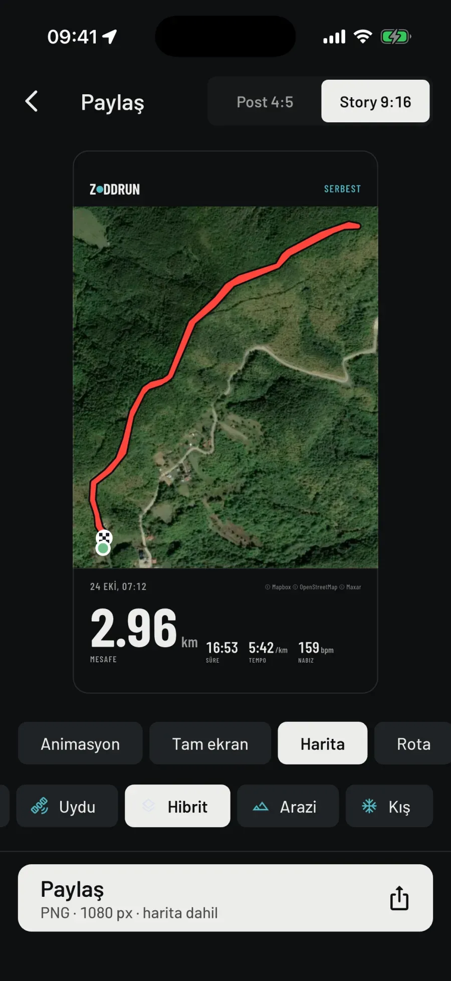
Map
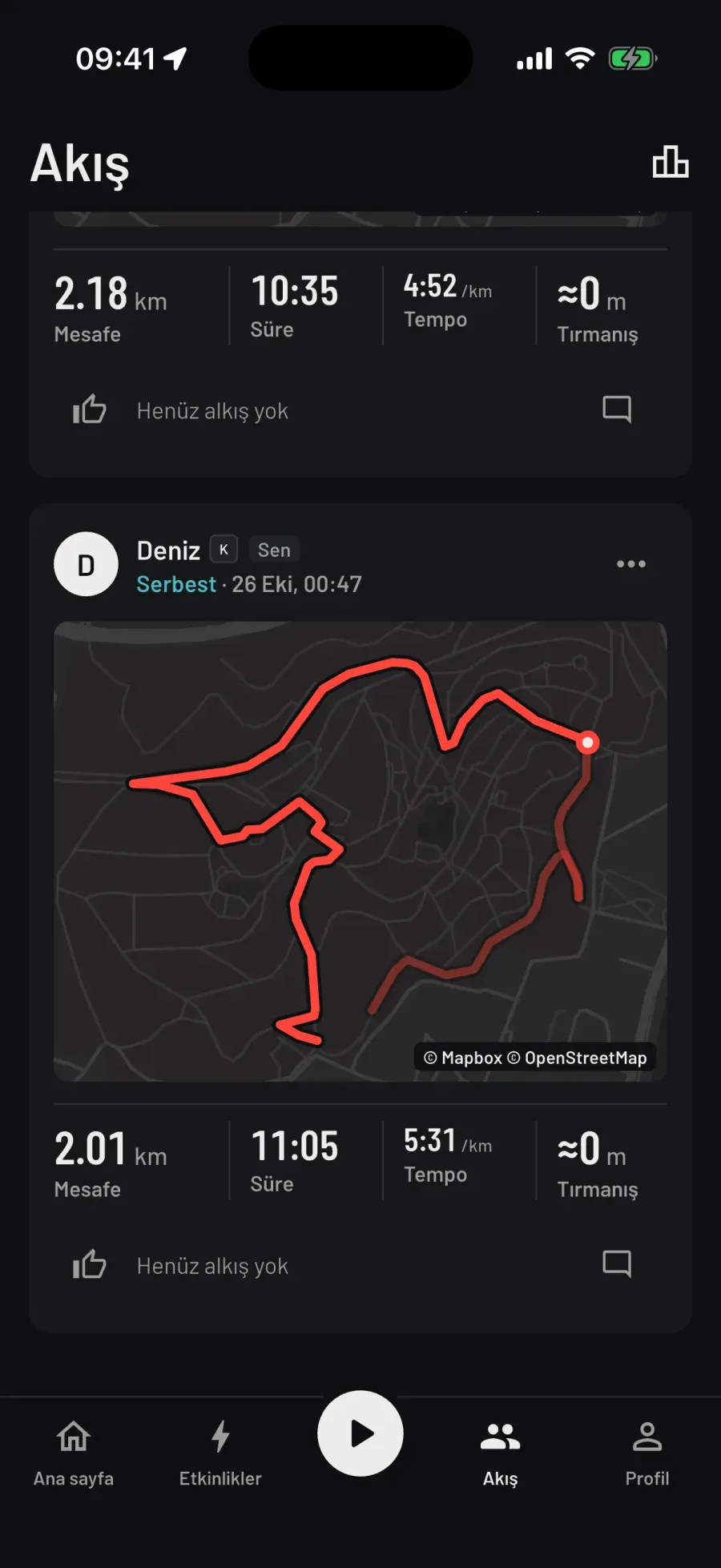
In the feed
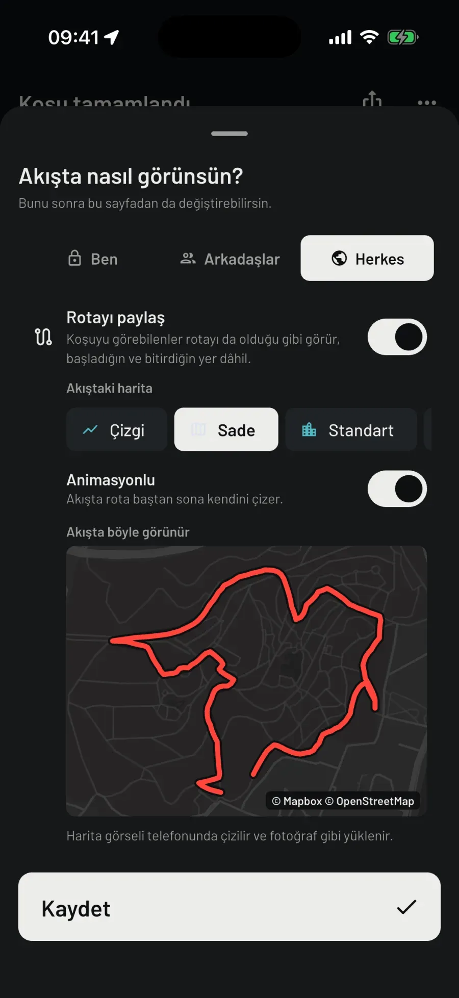
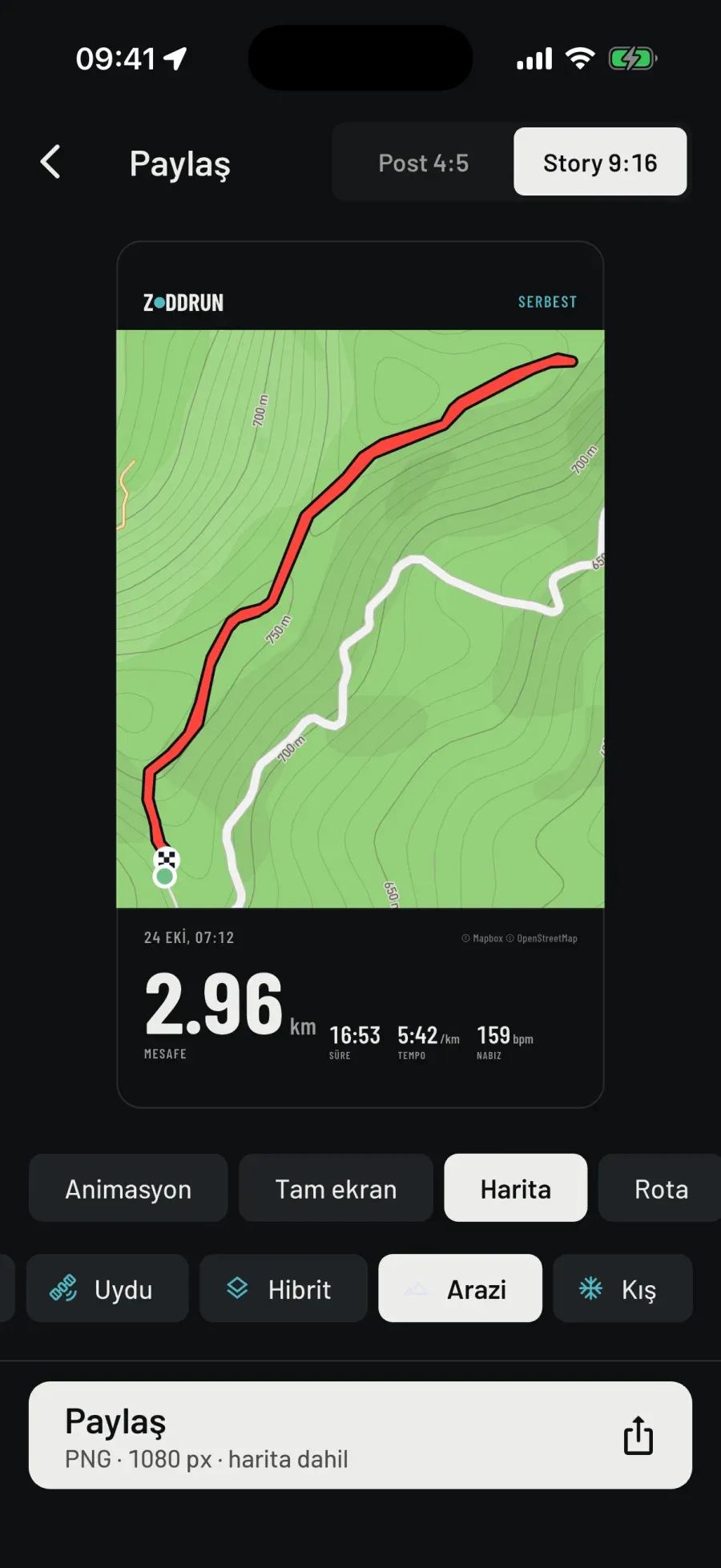
Animated
Photo
© Mapbox © OpenStreetMap © Maxar
-
Route map
Every outdoor run’s route is on the map when it ends; full screen marks Start and Finish, and the bottom says how many points were recorded.
The line is simplified; the raw track stays untouched on the phone. A pause breaks the route; ground covered during a break doesn’t go in as a straight line.
Treadmill, soccer pitch, pool: no route, no map. A run with a route exports as GPX.
-
Six map types
Minimal, Standard, Satellite, Hybrid, Outdoors, Winter. The choice applies to every map, including the run screen.
Outdoors: hillshade, contour lines, trails. Winter: the same map on a snow background; slopes and cable cars stand out.
Layers: places (cafés, shops, parks) and, as dashed lines, trails, footways and dirt tracks.
-
Heatmap: yours and everyone’s
Mine: every run’s route stacked on top of each other, running only. Worked out on your phone and never sent anywhere. Filters: period and time of day.
Everyone: four sport chips, run, walk, hike, ride. Public runs only, without names; 200 m around each start and finish is cut; only paths at least 3 people went along show up.
Everyone’s map is rebuilt from scratch every few hours. It holds no names, no runs and no times; only density. You can turn off your contribution in settings.
-
Offline map
Two areas: where you run, around your latest run, 16 × 16 km; where you are, 10 × 10 km. A downloaded area shows on every map even without signal.
It downloads with the selected map type; change the type and you download again. An area is tens of MB, satellite much more. With Outdoors selected, the terrain relief downloads too.
-
3D terrain
On the full-screen route map, with the Outdoors and Winter basemaps: elevation tiles, sky, a camera tilted at 50°. Two fingers tilt and rotate, the compass brings north back; the route’s line lies on the relief.
The small preview, the run screen and the Conquest board stay flat. When sharing, the Map and Flyover templates have a separate “3D” chip.
-
Share card
Post 4:5 or Story 9:16, PNG, 1080 px. Nine templates: Flyover, Full screen, Map, Route, Poster, Sticker, Dark sticker, Minimal, Splits.
The card carries distance, time, average pace, heart rate if there is one, best kilometre, kilometre splits, a new record, the game’s result, the date and the logotype. Its colours don’t follow the theme: a published image is the brand, not that day’s theme.
Templates without a map share no location. In the Map template the image is made on the phone, with the attribution at the bottom of the card. What you see in the preview is exactly what you share.
-
Photo and note
One photo and one note per run: from the camera or the gallery, editable later. Both follow the run’s visibility; with “Only me” the note never leaves the phone.
The photo is re-encoded on the server: longest side 1600 px, location and device data removed. On the feed card, the photo comes first, then the route.
-
Who has your route
“Share route” is on by default for a new run: people who can see the run see the route as it is, and one tap turns it off. The default look in the feed is the route drawing itself over a hybrid map; you can pick a line or another map type. The image is drawn on your phone and uploaded like a photo.
The map comes from Mapbox: it sees the area on screen and your connection’s IP address; your runs and route are not sent to Mapbox, and usage telemetry is off. Its logo stays on the map; the attribution is written on the image.
Maps, the heatmap, offline areas and sharing are free.
Download
Turn running into a game.
Sign in once, then run without internet too. If you like, leave the phone behind and run with the watch; the run is transferred to your phone.
Choose.Run.
iPhone · Apple Watch
Android · Wear OS
All features are free today.
Türkçe · English · Русский